
World State

World State
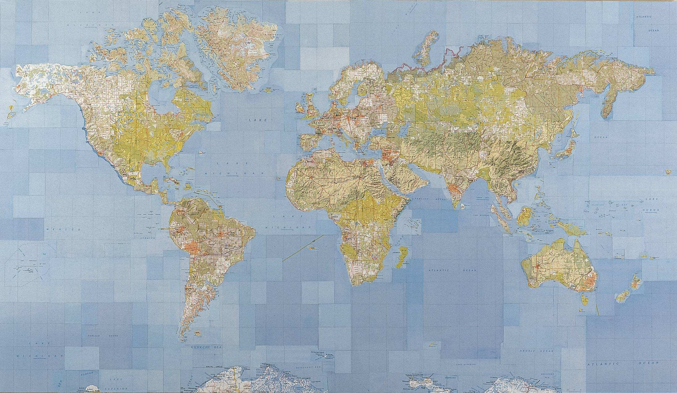
World State, 2001
106 ×
183cm,
Collaged USA topographical maps
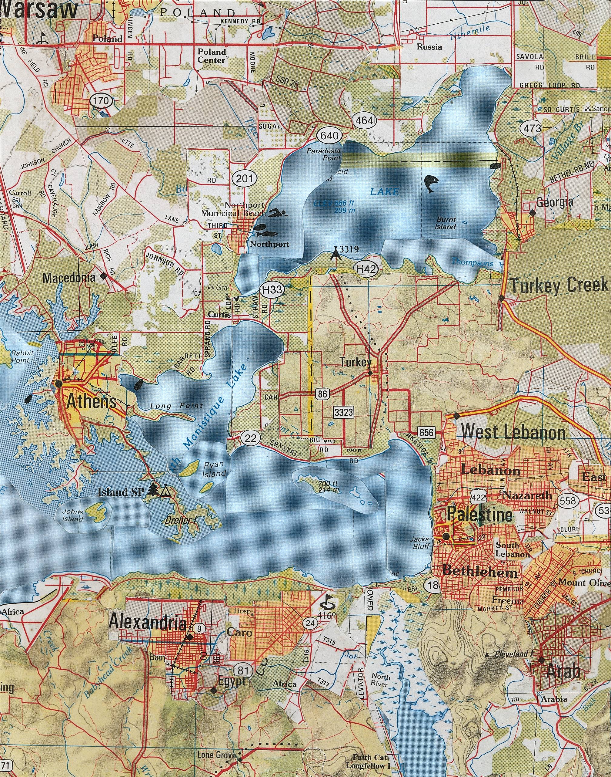
World State is a collage constructed from sections of USA topographical maps, cut from commercially available atlases, and re-arranged to create a world map. The USA towns and cities included in the collage are mapped where their namesakes would usually be found.
World State is one of three works examining the etymology of USA placenames given as a result of settlement and colonisation.
Related works
Exhibitions
